|
|
| Walk number 14 |
|
|
Upper Gatton and Chipstead (7.41 miles / 11.91 km / 3.75 hours):
|


 |
| Photos copyright © Graham Pearcey 2011 |
|
Please click here for a map of the route.
|
- Use the large public car park on High Road, Chipstead, Coulsdon, opposite Elmore Lodge, CR5 3SB.
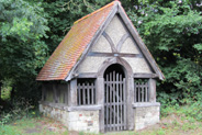
- Walk to the right of Elmore Pond and turn left onto the pavement. Cross the junction with Elmore Road, remaining on High Road; pass an old well house (on your right), built in the 1800s and restored in 1989, but remain on the left-hand pavement to pass a post-box. At the entrances to Chipstead Football Club (left) and Shabden Park (right), cross to continue on the right-hand side of the road. Immediately after the grass verge turns into a proper pavement, cross back and take the signed footpath through a green gate, which soon brings you to Hogscross Lane via a second green gate. Turn left and walk along the road for about 50 metres.
- Take the signed footpath to the right, between Noke Farm Cottage and Noke Farm Barns (an apartment block). Go through the (broken?) kissing gate; as the track bears left you keep right alongside a fenced area and continue downhill to a barrier. Maintain direction, with the hedge to your right, until you reach the bottom of the slope. Turn right then immediate left. Follow a path diagonally across the next field, upwards to a visible (broken?) stile, then walk uphill through woodland (effectively two lines of trees). Cross another field. At the far side, turn right before you reach the hedgerow, and follow the permissive path with the hedgerow on your left, signed Shabden & Upper Gatton Circular Walk (SUG). Go through two fields and shortly after arriving in a third field you will reach a gap in the trees to your left. Turn left through the gap (also signed SUG) but maintain direction on an initially narrow path, following the right hand field edge.
- After some time, meet a track that sweeps to your right and straight ahead, but donít join it. Instead, turn left and follow a narrow overgrown footpath which goes into, and straight on across, a field (through tall crops during some seasons). Cross a stile and go right, then immediate left signed SUG before keeping left along the edge of the field near to the hedgerow. Cross a stile that leads you out onto Harp Oak Lane. Turn right and follow the road, ignoring the private driveway on the left and proceeding carefully to the next turning on the left. Go through the kissing gate and along a track, past a cottage on the left and then left through another kissing gate at the entrance to Boors Green Farm. Follow the right hand field edge to and through another kissing gate. Go left then shortly right through a fourth kissing gate and follow the path straight on with the hedge to your right. (If itís too boggy, walk along the higher ground with the same hedge to your left.) Go through another kissing gate and carry straight on until you come out into a large field with the M25 in front of you.
- Turn immediate right and follow the field edge for some time until you reach a gap by a bench. Turn right here then bear left to follow the grassy path between the fence (right) and hedgerow (left) to Markedge Lane. Proceed through a gap in the hedge and cross the lane towards a private gateway, but then turn left and proceed carefully along the right-hand side of the road.
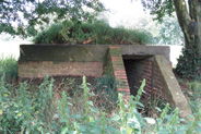
- Pass the tarmac entrance to Lodge Farm Fencing, which is on private land, but turn right through a subsequent metal swing gate, onto a signed bridleway that takes you back towards Lodge Farm Fencing then across a track into a green field. Proceed straight ahead but, before reaching the far side, turn left and follow the field edge (with the woodland on your right). At the corner of the field, cross a stile and follow a path through Upper Gatton Wood. (Bear left at the first marker post and proceed straight ahead at the second.) Pass a somewhat concealed old air-raid shelter to your left before crossing a stile to leave the woodland.
- Pass to the right of another (better preserved) air-raid shelter and keep right. At the far end of the field, a stile to your right comes into sight at the last minute. Exit into High Road. Cross the road diagonally right. You have reached the half way point of the walk.
- Take the footpath that enters a field via a new swing gate and descends towards the bottom of a dip. From the bottom, the path climbs up again. At the top pass through another new swing gate, cross the road, then pass through another swing gate to the left of the cottage, and on over a stile. Go through a kissing gate. Maintain direction with the field edge to your right, ignore a footpath on the right, and proceed downhill to the corner of this field. Pass through the hedge line, turn left and then shortly turn right and follow the rising path beside another hedge (keeping this hedge on your left). At the next corner, turn right and follow the next field edge. Cross two stiles signed Millennium Trail, then cross Green Lane and follow the path straight on, beside woodland and fields (left) and the backs of houses (right). Cross Monkswell Lane, carry straight on through a kissing gate and maintain direction across the field. Go through another two kissing gates and then downhill through the woodland to reach Chipstead Lane alongside the Well House Inn.
- Cross the road, and climb the hill before carrying on into woodland. (The stile comes into sight at the last minute.) Proceed straight ahead at the golf course, after a while bearing right as Millennium Trail marker posts guide you towards woodland to the right hand side of a cream coloured house. Go straight on into the woodland and then out onto Waterhouse Lane. Turn right here. Ignore the first turning on the right, but take the second turning, signed as a bridleway. Once you reach houses, follow the road to the left passing the pond on your right. Continue between the houses and through a gate.
- Pass semidetached cottages, but on reaching the gateway into Ganton House turn right, back onto the golf course. Proceed straight ahead, to the left of the tree line, then steeply downhill. Enter Long Plantation and go straight ahead at two cross-paths. At a fork in the path, bear right downhill and pass through a kissing gate into a field. Carry on downhill towards another kissing gate, but turn left before it (signed Permissive Footpath) and climb the field diagonally towards a corner. Here turn left to proceed with a raised bank to your right, until you reach a gate. Go through this gate, turn right and follow the track through woodland. Pass Shabden Park Farm on your left and reach High Road. Turn left and retrace your steps to your car.
|
|
This route was last walked on 24 May 2024, and the directions were accurate then. Please e-mail me if you find any errors, if you would like a copy in Word format, or if you would prefer a version that starts and ends at Chipstead station (add 1.68 miles/ 0.75 hours).
|
|
Return to my Surrey walks page.
|
|


